Gallus Running
Craigmore hill run

Craigmore hill run

Length
6.8 Kms
Elevation gain
420.5 m
Max elevation
387.1 m
Difficulty
****
Rating
****
Type
Out and back
Route id
533
Main road
1.2 Kms
Country road
0 Kms
Dirt road
0 Kms
Dirt path
0 Kms
Trail
5.6 Kms
Markers, units and tools
Show direction markers
Show highlight markers
Swap units
Get GPX
OS Map
Directions to start point
Route summary

The Craigmore hill run route is a trail run within Loch Lomond and the Trossachs. The out and back covers a distance of
6.81 Kms ( 4.23 miles )
and has an elevation gain of
420 m ( 1379 feet )
.

Description
This is a short and tough run with just under
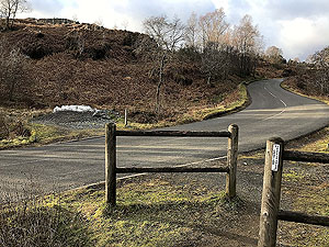
400 m
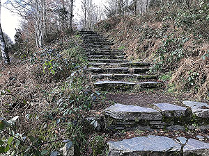
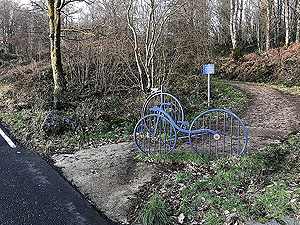
of climb within the outward section of this out and back run. The route leaves from the main car park in Aberfoyle turning left and follows the pavement up the main A821 road towards Loch Katrine going over the Dukes pass. When the pavement ends there are two entrances into the first part of the wooded section. You can take the stairs and turn left or stay on the road for
5 m
and take the track marked by two iron bikes.
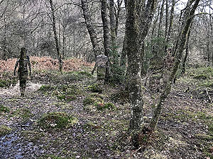
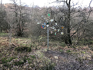
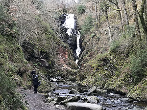
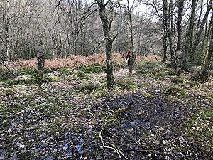
The wooded area has lots of tracks so best to either download a map or use the GPX file. Use the direction information to help guide you, but you are basically following the route to Callander over the Dukes pass. This goes past various pieces of art, past the large waterfall and circles round and to the right of the David Marshall lodge. Eventually the path takes you out at the main road where you cross and continue on the path.
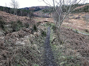
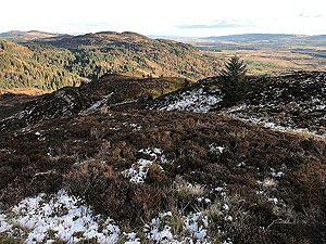
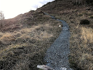
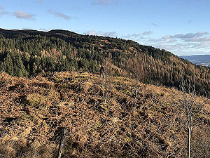
You have now left the wooded area and out in the open. After a short distance the path reaches a tee junction. Turn left and follow the path for a short distance (about
100 m
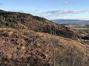
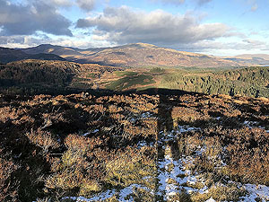
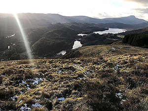
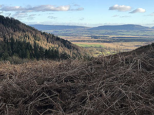
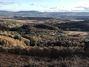
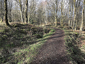
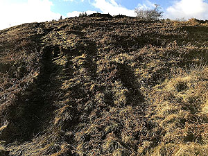
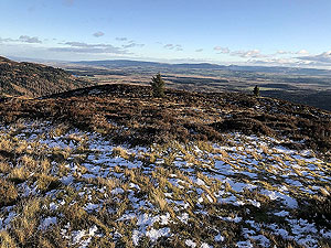
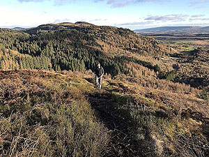
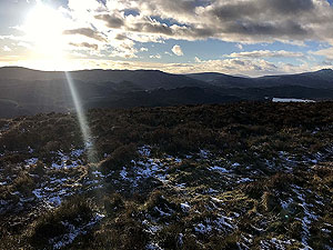
) before taking the less obvious path to the right that heads uphill. We have included a picture of the start of the path at this part so you can see how it looks. The path does improve but is narrow and boggy in parts and continues the relentless uphill. Towards the summit the path becomes steeper for a short section with one small false summit before the real end. Lovely views at the top and on the way up so take a breather and enjoy when you can. It is all down hill from this point, though that is a tough as well on this route for the start of the descent.
Route directions
Kms
1
Head out of the car park past the tourist office towards the main road.

0
2
Turn left at the main road.

0.1
3
Follow the main road up to the right as it heads up the hill. Welcome to the start of the climb.

0.2
4
The pavement ends just after the entrance to the bowling club. However, taking care keep on the main road for about 50 M before turning to the right inot the woods. The entrance is marked by two metal bicycles

0.6
5
At the first tee juntion inthe path take the path heading to the right.

0.7
6
Follow the signs for the waterfall heading rihgt.

0.9
7
Going past the mirror people

1.1
8
Past the waterfall and follow the path uphill, take the turning on the right after a small bridge. Avoid heading to the David Marshall Lodge

1.2
9
You now reach a crossing of the main road. Take care crossing and follow the path on the other side.

1.9
10
Once you reach the tee junction in the path, turn to the left.

2
11
After about 300 M you will see a faint path on the right heading up the hill. Take this path. A picture is shown in the picture section

2.4
12
And welcome to the top of Craigmore. Enjoy the view and it's all downhill from here. Back the way you came.

3.4
13
Another junction so turn to the left back along the smaller path.

4.4
14
Back across the main road and following the way you came.

4.9
15
Keep following the pavement and it bends to the left then back onto the main road.

6.5
16
And turn right at the tourist information towards the car park.

6.7
17
And back at the car park. Several places to eat in Aberfoyle - try the Aberfoyle deli if you are in a hurry.

6.8
Entrance to the woods
Craigmore.
Entrance to the woods
Craigmore. Image from Craigmore
Image from Craigmore
Initial path in the woods
Craigmore.
Artworks in the woods
Craigmore.
Artworks in the woods
Craigmore. Image from Craigmore
Image from Craigmore
Artworks in the woods
Craigmore. Image from Craigmore
Image from Craigmore
The large waterfall
Craigmore.
Main road crossing
Craigmore.
Good path for parts
Craigmore.
Various views from the middle part of the climb
Craigmore.
Various views from the middle part of the climb
Craigmore. Image from Craigmore
Image from Craigmore
Various views from the middle part of the climb
Craigmore. Image from Craigmore
Image from Craigmore
Various views from the middle part of the climb
Craigmore. Image from Craigmore
Image from Craigmore
Various views from the middle part of the climb
Craigmore. Image from Craigmore
Image from Craigmore
Path not so well defined in parts
Craigmore.
Looking downhill
Craigmore.
Near the top
Craigmore.
Near the top
Craigmore.
Views from top of Craigmore
Craigmore.
Views from top of Craigmore
Craigmore. Image from Craigmore
Image from Craigmore
Views from top of Craigmore
Craigmore. Image from Craigmore
Image from Craigmore
Gallus Running web site is using cookies to enhance the visitor experience. See our cookie policy here.Accept cookies