
Highland Fling
The Highland Fling route is a trail and some small road run within Loch Lomond and the Trossachs. The point to point covers a distance of 85 Kms ( 52.82 miles )
and has an elevation gain of 2300 m ( 7546 feet )
.
Length
85 Kms
Elevation
2300 m
Max elevation
337 m
Difficulty
*****
Rating
*****
Main road
0 Kms
Country road
8.5 Kms
Dirt road
0 Kms
Dirt path
0 Kms
Trail
76.5 Kms
;)
Description
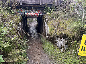
The race starts in the centre of Milngavie outside the railway station. Iniitally through a short underpass and then into an enpty shopping centre for the first
200 m
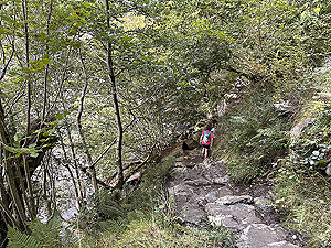
before starting on the West Highland Way proper and a small dirt path. This part is crowded and you have to run more or less at the pace of the group. This will be in darkness with most runners using a headtorch, but it does make for uncomfortable running. However, at just over 1.3 Kms
you start to leave Milngavie behind and the path opens up and you are on your way towwards the first checkpoint. Daylight will appear in this section, but sunshine might be in short supply given that it is Scotland. There is some nice running in this section although you have to be careful of not going too fast. You soon reach the checkpoint 1 at 12 Kms
, Beech Tree, where you get to use your timing chip for the first time. At each checkpoint there are two marshals with the timing chip readers where you simply insert your chip (on a lanyard around your neck), recieve a wee red light and you are off.
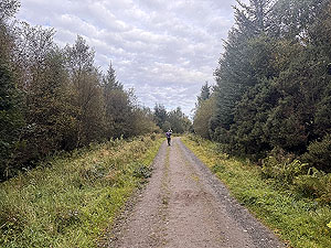
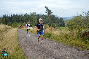
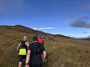
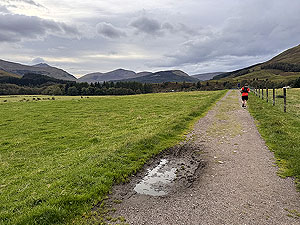
Onto the second section and the route out to Drymen with a mix of trail, path, small road and a field to contend with. This seems to be the first part where conversations start to occur between runners. Although there are a few small hills this part of the route doesn't seem to bad. You arrive at a small field where the route goes over a wee hill then heads up to the main road crossing and into checkpoint 2 , Drymen, at
20 Kms
. From here the race starts to get tough.
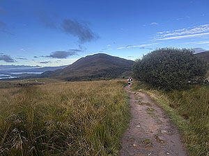
Once past the checkpoint there is a very small section beside the road before taking a right turn and the trail towards Conic hill. This is about
10 Kms
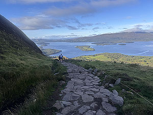
of climb with some sections of flatter trail. At 28 Kms
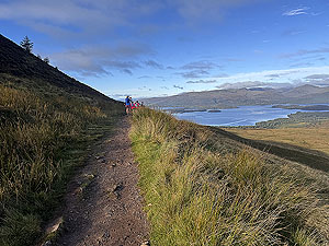
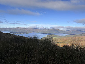
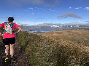
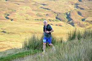
the trail reallly starts to climb and where most runners have decided to walk. Once at the top of Conic hill you are rewarded with wonderful views over Loch Lomond. The downhill section is made up of large man laid rocks in the form of steps. Runnable but with caution and we did notice only a few of us were running. This is also where you come across a lot of walkers heading up the hill so you need to be very careful. For us the day was dry at this point so the steps weren't slippy. With checkpoint 3, Balmaha, at the bottom of the hill the added bonus of it being the first bag drop means you can get wee break as you try to work out why you put so much stuff into that first bag.
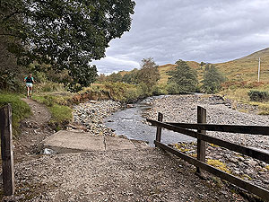
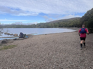
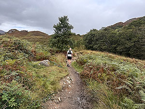
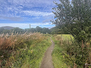
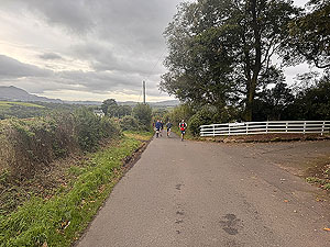
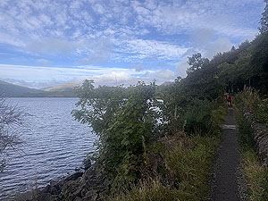
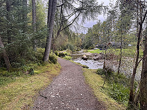
The next section is mostly trail where it goes up and down every small hill that is possible to go up and down. Nothing too bad and there are parts where you are right down beside the loch, even on the shingle beach at times. A lot of trails are narrow but easy enough to get past both walkers and runners. Some sections you have to cross the small road, or indeed run sections so be careful here as this can get busy with tourists and camper vans. This section is about
12 Kms
long and takes you to checkpoint 4, Rowardennan. This checkpoint is also the first cut-off with a limit of 6 hours and 45 minutes from the start.
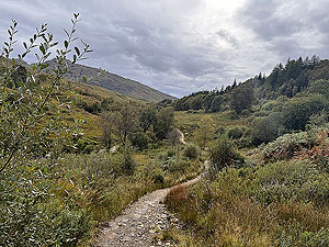
On leaving the checkpoint you are in the big Ben Lomond carpark which we found a little confusing as no runners in front to guide us. However if the same happens to you then just follow the WHW yellow markers round the car park and onto the dirt road. A lot of this section is on a wide dirt road and what feels like nice steady running. A real good section for a chat with fellow runners and you do now start to see people struggle. The later part of this section does include a
100 m
hill which is rather steep. The final parts of the section become more technical running and you really start to notice the strain on the legs. You cross a bridge over a waterfall just before checkpoint 5, Inversnaid, and descend some awful stairs at the hotel before reaching the second bag drop at 55 Kms
. We did notice that runners were taking thier time here, making sure to take some energy in. The hardest part awaits.
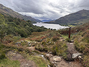
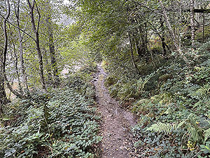
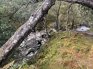
The section from Inversnaid to Beinglas is
11 Kms
but be aware that for most runners this will take over 2 hours. The first 8 Kms
of this part is very technical and in parts almost impossible to run. You get short sections where you can get a run, but generally it is a fast walk or even scramble. Rocks and tree roots seem to go out of thier way to try and trip you up and the views of the loch are hard to take in as you have to concentrate so hard on the path ahead. After the first 8 Kms
the path improves but instead of being very technical it now starts to climb. The views on this section can be wonderful. Eventually a downhill takes you onto checkpoint 6, Beinglas. Just about a half marathon to go, but this checkpoint does end the race for a lot of runners.
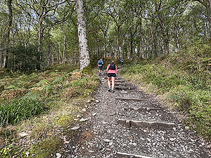
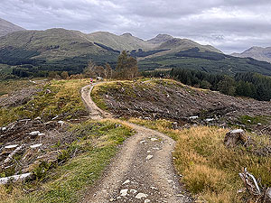
The second last section and it's really about digging in from now on. The path is pretty good to start with but soon reverts back to uneven ground mixed in with better parts. This section also includes the biggest climb of the day. It does seem that every corner you go round there is a new climb waiting. Although most of the runners were walking up the steepest parts, there are lots of flatter sections where you can keep running. This part is also very out in the open which although dry on our race day must be a nightmare at other times. Again some wonderful views as you start to turn more west at the back of Crianlarich and the final checkpoint 7, Bogle Glen.
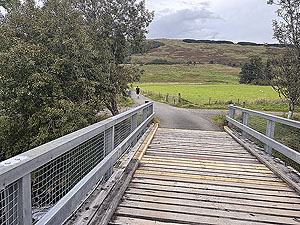
So off you go on the final part, easy now. Well not really as you still have to finish off the hill you are on. So more climbing awaits for a short time before you start the downhill. The downhill is mostly trail consisting of loose rocks which can be difficult on sore legs. There is crossing of the main road at
80 Kms
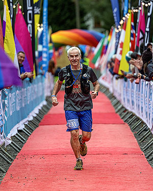
where you are told it's "just" a Parkrun to the finish. This part is easy running on a mix of good quality track, small tarred road and trail. Eventually Tyndrum appears and you are down at the river and closing in on the finish and what a finish it is. You round the corner onto the station road and into the camp site. A sharp turn gives you first sight of the finish line. Beware though as the final checkpoint is just before the red carpet, so get the tag activated and then enjoy the glorious run along the red carpet (yes there is a red carpet) to the finsh line. Perhaps the best finish line ever, or is that just the emotion ?
Getting in
With the limited slots available for this race it is recommended to sign up as soon as you can. You are asked to prove that you are capable of running a marathon in a certain time or have experience of running ultras. This is checked so be honest.
Getting there
Although the race starts at Milngavie railway station the time of the morning means no trains. The race organises buses, seperate cost, from Glasgow centre and from Tyndrum at the finish. Long stay parking is also available at the rugby club with short stay parking if getting dropped off available nearby.
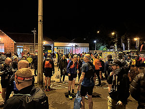
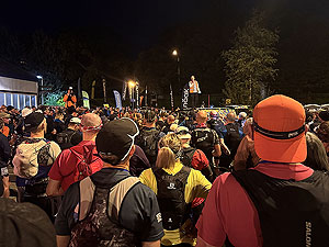
Start
Milngavie railway station is the start line for the race. There are several starts, the first being the 5am for slower runners who request an early start. The main group of runners sets off at 6am and is split into three groups depending on estimated finish time. This is you that decides on what time is most likely - this is a decision on the day and not based on times used for entry. Under 10 hours, between 10 and 12 and the third group over 12 hours. All the groups start within 10 minutes of 6am.
There are lots of temporary toilets available and parking is at the nearby rugby club (free and available till the Sunday afternoon). The bag drops are easy to find along with the lorry to take a small bag to the finish line. First register and get your number and from there to the next table to get your timing thingie. The timing thingie is needed at all check points including at the finish. The usual race briefing is held about 15 minutes before both the 5am and 6am starts.
End/Finish
The finish is in the small camp site "By the way" which is beside Tyndrum Lower railway station.
Perhaps the best finish line we have experienced. Completing this run is rather emotional and here you actually run on a red carpet to the finish. Brilliant. Marshals are there to organise your final picture and present you with the goodie bag. They also magic your bag from Milgavie as if by magic. There is food, showers, tea, coffee, mechandise all available at the finish area. The finish is beside Tyndrum lower station and keep in mind that the walk to the other station, Tyndrum upper is up a long hill.
Staying
This is a complex decision as the race is a point to point. So you can either choose to stay in Glasgow centre, Milngavie or Tyndrum. The race organises buses between the locations
mentioned so it's up to you to decide if you want a really early start and a bus transfer and/or stay the night at Tyndrum.
Hotels and other accomadation does fill up quickly so book something as early as you can.
Details last updated in September 2025.
Cost
The cost in 2025 was £120
When
September
Entry Opens
Janurary
Web site
Race size
Limited in 2025 to 750 runners
Last ran by us
2025
Route images


Directions
×