
Strathearn marathon
The Strathearn marathon route is a country road run within Perthshire, Kinross & Angus. The loop covers a distance of 42.12 Kms ( 26.17 miles )
and has an elevation gain of 439 m ( 1440 feet )
.
Length
42.1 Kms
Elevation
439 m
Max elevation
237 m
Difficulty
***
Rating
****
Main road
10 Kms
Country road
32.2 Kms
Dirt road
0 Kms
Dirt path
0 Kms
Trail
0 Kms
;)
Description
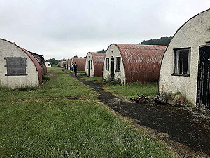
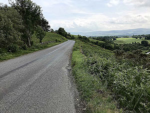
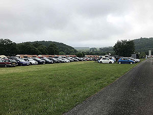
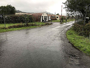
A drive of less than an hour took us to the unusual start location of Cultybraggan. Although the roads there are quiet they are narrow so take care looking out for other cars and wild animals. The world war two prisoner camp site is strange in the early morning with the pre race period feeling rather unreal. That said, it is a small marathon and the people you meet are friendly with folks willing to chat.
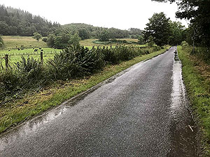
A piper plays and you are off on the start on one of the country roads around the camp. This race tricks you with a bit of a downhill for the first
0.5 Kms
before the first round of torture starts. Over the next 8 Kms
it is nearly all uphill, with a short downhill section about 4 Kms
in. At about 5.5 Kms
you leave the small country road and join the main B827 road.
The race has a few more hills for you to tackle along the way, these being at
17 Kms
, 23 Kms
and 30 Kms
with each one being slightly smaller than the one before. The last 3 Kms
are also on an upward incline just to finish you off in style.
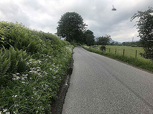
A short section of the race is on the main A822 and there feels like a lot of traffic. Mostly though the country roads have very few cars and it all feels rather relaxing. Well as relaxing as you can with all the elevation. During the second half of the race the runners are well spread out and you can feel like you are out on your own at times.
This is a small event so don't expect large crowds along the way. The people you do see are very supportive though with the biggest gatherings near to Crieff and in the village of Comrie.
Getting in
This is generally an easy race to get into right up until a few days before the event. At the time of writing entry this was through Entry Central.
Getting there
This race is not too difficult to get to from central Scotland. The Cultybraggan site is about a 30 minute drive from the A9 running between Stirling and Perth. Public transport options are more difficult and may involve an overnight stay.
The race web site includes travel information.
Pre Run
No pre runs but if you are staying in the area there are some good runs available.
Start
Culttybraggan camp.
End
Back at the camp.
Finish
A giant red squirrel meets you at the road leading to the camp and is always good for a high five. No idea why things like that give you a wee boost, but it was appreciated. It feels like huge crowds at the finish line and a tough marathon completed.
This race is famous for the cakes and soup post run. Get those legs filled.
Staying
Various options are available in Comrie and beyond. The race also offers overnight camping at the camp for a small charge. Information on that is also available on the race web site.
Details last updated in June 2026.
Cost
The base entry cost for unaffiliated runners in 2026 was £37.
When
The race is held at the start of June.
Entry Opens
Entry opens at the start of the year.
Web site
Race size
300
Some years the amount of runners is smaller.
Last ran by us
2018
Route images
Directions
×