
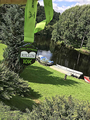
Killin 10K race
The Killin 10K race route is a country road run within Loch Lomond and the Trossachs. The loop covers a distance of 10 Kms ( 6.21 miles )
and has an elevation gain of 149 m ( 488 feet )
.
Length
10 Kms
Elevation
148.6 m
Max elevation
152 m
Difficulty
**
Rating
****
Main road
0 Kms
Country road
9.5 Kms
Dirt road
0.5 Kms
Dirt path
0 Kms
Trail
0 Kms
;)
Description
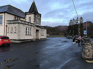
Arriving in Killin and driving to the north side of the town you will see signposts for the parking for the run. This is in a big field just off Lyon Road and is free. From there a short walk takes you to the village hall for number and tee shirt pick up.
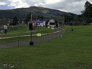
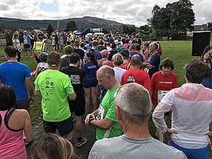
The start line is in the middle of the park and provides great views of the surrounding hills. This is well organsied and has a very friendly feel to it.
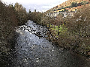
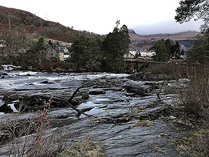
The race starts with the run through the village itself then over the bridge at the famous Falls of Dochart. After the bridge a sharp left turn takes you back north crossing the old viaduct and past the car park before coming onto the main A827 road heading north.
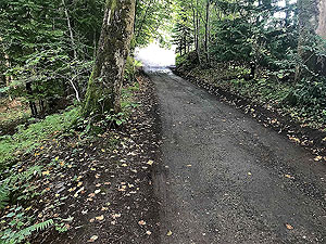
You have a short section on the main road before a left turn takes you along the single track road on the south side of the River Lochy. This is a really pleasent run up the glen before you hit the small hill at
5.7 Kms
. This short hill takes you to the turning point and back down the north side of the river back to the main road.
Once back at the main road you have just over
1 Kms
back to the park and the finish line.Getting in
This is generally an easy race to get into even shortly before the event and entry is available on the Tay Fitness web site.
Getting there
The town of Killin is located at the south end of Loch Tay. Most people would access from the A84 heading towards Crainlarrich then taking the A827. The only public transport would be bus from Stirling.
Pre Run
No pre runs but if you are staying in the area there are some good runs available.
Start
Breadalbane park.
End
Back at the park.
Finish
Good crowds at the end of the race and plenty of places to go afterwards for something to eat or drink
Staying
Killin is located in a busy tourist area so there are numerous options for staying including in the village itself.
Details last updated in August 2024. Updated with 2024 prices.
Cost
The cost in 2024 is £25 .
When
TBC
Entry Opens
Entry opens at the start of the year.
Web site
Race size
700
670 in 2024.
Last ran by us
2024
Route images
Directions
×