
Run through Glen Fruin
Length
27.4 Kms
Elevation gain
416.9 m
Max elevation
196.4 m
Difficulty
**
Rating
***
Type
Loop
Route id
534
Main road
0 Kms
Country road
0 Kms
Dirt road
0 Kms
Dirt path
0 Kms
Trail
0 Kms
0

Route summary
The Run through Glen Fruin route is a country road run within Central & West. The loop covers a distance of 27.41 Kms ( 17.03 miles )
and has an elevation gain of 417 m ( 1368 feet )
.
Description
This is a fully tarred route that offers a good mix including a
417 m
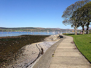
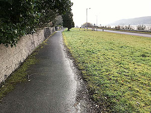
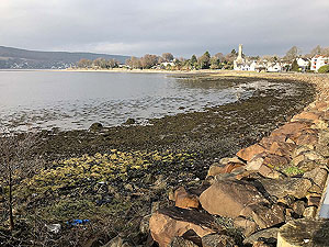
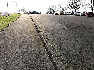
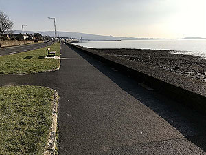
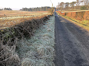
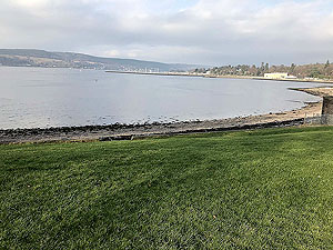
climb along the way. We start this route at the Kidson Park car park although you could easily use the pier car in Helensburgh or lots of street parking. The reasons for this choice is that it allows you to take in some of the famous blossom streets (a spring time must) , helps split the uphill out of Helensburgh and is also a lovely spot for finishing the run. Oh and there is a wee Cafe.So head from the car park back towards Helensburgh along the lovely waterside pavement the runs beside the A814. Early in the morning on a sunny day this can be a perfect start, though a wet winters afternoon is something else. You follow the pavement until you reach the small water treatment building which is shortly after where the small wall on the right finishes. From here cross the main road and head up Suffolk Street. Generally, we do like the locals and stay on the road as the pavements are not so great, take care though. Helensburgh is in a grid system, so keep on Suffolk Street for three blocks then turn right onto West Argyle Street and into the blossom trees. Follow this road (part of the Helensburgh 10k) for 6 blocks then turn left up Colquhoun Street and start climbing. The road meets the west highland railway so a quick turn right, one block then a turn left and up Sinclair Street and out of Helensburgh.
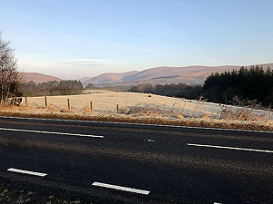
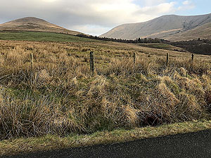
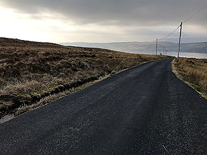
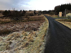
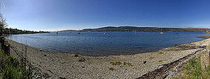
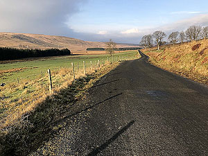
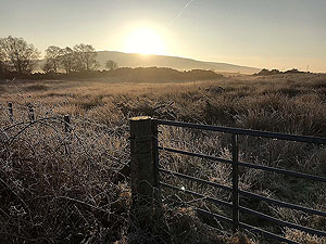
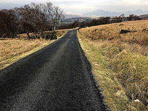
The road out of Helensburgh is the A818 and keep to the right-hand side of the road. This does feel like a long uphill slog but once at the old skating pond the climb does stop. You are on the cycle/walking path that runs alongside the main road. Some lovely views of Ben Bouie, and down Glen Fruin along with Loch Lomond. Although you can head into the first entry into Glen Fruin for this route we stay on the A818 path until the cross keys and head into Glen Fruin from the small roundabout.
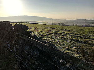
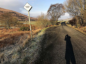
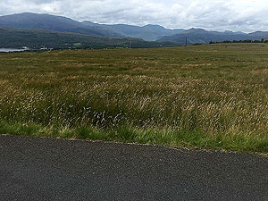
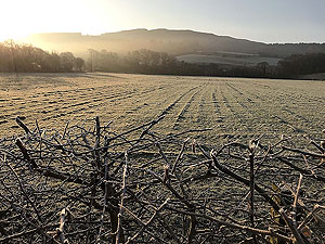
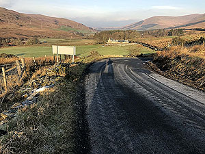
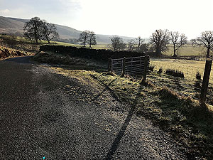
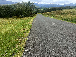
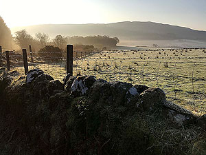
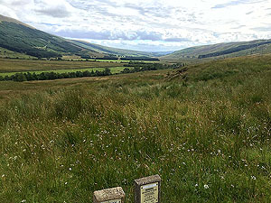
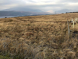
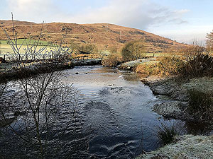
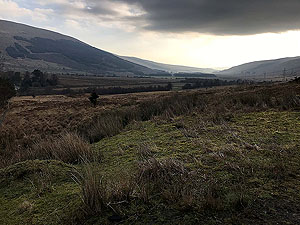
Running through Glen Fruin is brilliant. This is a small single-track road but with very few cars and is the major part of this run. A short uphill become a short downhill before a long flat. The road heads back uphill at the end of the glen and provides brilliant views of the Arrochar Alps and down along the Gareloch.. and even a wee submarine base.
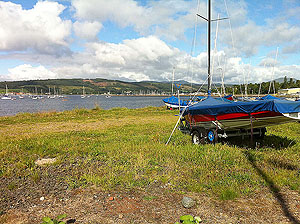
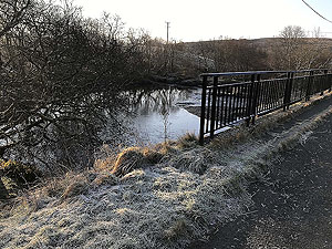
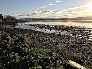
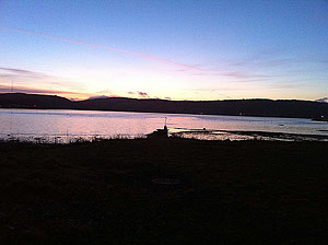
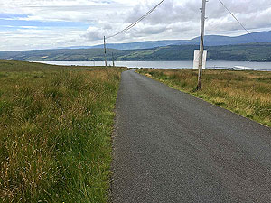
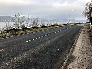
You are back on the main A814 once under the railway bridge and from here it is pavement running back to Helensburgh. For most of the route once past the submarine base the pavement is actually on the old road, so you are away from the traffic for most of it. This is probably the dullest part but can be beautiful on some mornings. The route takes you into Rhu, Brae shop for a wee roll and sausage, then along beside the loch/river back to the car park.
When finished, depending on time of day, there are two recommendations. Fish and chips from the Wee Kelpie and ice cream at Dinos. Don't miss these if you can, with both being on Clyde street a short distance from the pier.
Route directions
Kms
1
Leave the car park and head towards Helensburgh, keeping to the path on the river side.
0
2
Keep on the path beside the river
0.3
3
Turn left at the small water treatment plant, going up Suffolk Street for three blocks.
1
4
Turn right along West Arglye Street - enjoy the blossom in spring.
1.4
5
Turn left at Colquhoun Street and start to climb
2
6
Turn right at the end of the road for one block
2.7
7
Turn left and head up Sinclair Street past Helensburgh Upper station
2.9
8
Cross to the right hand side of the road. If you have time you could also take a quick left to view Hill House.
3.4
9
Keep on cycle path past the recycle centre
4.3
10
At the small Cross-Keys roundabout take the left onto the single track road for Glen Fruin
7.5
11
At the Black Bridge junction keep going forward further into the glen.
11.3
12
The road now starts to climb
16.2
13
And now the downhill
17.2
14
And under the railway bridge
19.5
15
Now at the man road, A814, turn left, cross the road and run beside the submarine base
19.6
16
The pavement ends and you cross the road to run on the old road.
22
17
And into Rhu
25.2
18
One past the Rhu Inn cross the road to the shoreline path
25.7
19
Past the sailing club - nearly finished
27.2
20
And back to the car park. Time now to stretch and consider a visit to Dinos for ice cream.
27.4

Kidson Park

View up the Gareloch

Kidson Park

Kidson park car park

Towards Helensburgh on Clyde Street

Path along Clyde Street towards Helesnburgh

Out of Helensburgh on cycle track

Sun coming up over the top of Ben Bouie

Out of Helensburgh on cycle track

First good view of down Galn Fruin

First section of Glen Fruin

Towards Ben Bouie

First section of Glen Fruin

View back towards Ben Bouie

First section of Glen Fruin

Heading into the glen

On downhill section

The Clyde in the distance

On downhill section

Start of the descent into the glen

The Black Bridge

The Black Bridge and an old popular picnis spot

Craig's pool area

Famous in Helensburgh for the picnic spot and a wee swim

Craig's pool area

View from beside Craig's pool down the glen

Middle section of the glen

View back down the glen

Middle section of the glen

The single track road continues

Some wildlife

Friendly cows are always worth a wee hello

Start of the hill out of the glen

End of the flat bit of the glen

Start of the hill out of the glen

At the army training camp, just before the climb out of the glen

Hill towards the Gareloch

Back down the glen from the start of the hill

Hill towards the Gareloch

Towards the Gareloch and submarine base

Hill towards the Gareloch

Towards the Arrochar alps

Hill towards the Gareloch

The battle of Glen Fruin stone

Hill towards the Gareloch

Information board about the battle

Hill towards the Gareloch

Last look back down Glen Fruin

Hill towards the Gareloch

Heading down the hill on the way back

Coming down the hill

View towards the Cobbler

Coming down the hill

Arrochar alps

Coming down the hill

Arrochar alps in the distance

Old road at Shandon

The old road has little traffic other than that from the local houses

Towards Rhu point

Rhu point in the sunshine

Past Rhu and Ardencaple

Looking towards the Clyde from Rhu

Past Rhu and Ardencaple

Looking back up the loch before entering Rhu

Past Rhu and Ardencaple

The village of Rhu

Sailing club area

Helensburgh sailing club

Sailing club area

Sunset from Kidson park

Arriving back at Kidson park

View down the Gareloch with the Ardencaple hotel on the right.