Gallus Running
Bennachie longer hill run

Bennachie longer hill run

Length
11.6 Kms
Elevation gain
495 m
Max elevation
510.9 m
Difficulty
***
Rating
****
Type
Loop
Route id
548
Main road
0 Kms
Country road
0 Kms
Dirt road
2.7 Kms
Dirt path
8.5 Kms
Trail
0.4 Kms
Markers, units and tools
Show direction markers
Show highlight markers
Swap units
Get GPX
OS Map
Directions to start point
Route summary

The Bennachie longer hill run route is a trail run within North & Grampian. The loop covers a distance of
11.62 Kms ( 7.22 miles )
and has an elevation gain of
495 m ( 1624 feet )
.

Description
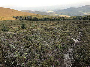
A very popular route with the locals for a walk, cycle or even a run. This particular route does keep you on quieter paths until you approach Mither Tap, the final summit. A short to medium length route which is tougher than you think due to all the elevation gain. Good paths for nearly all of the route.
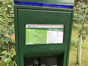
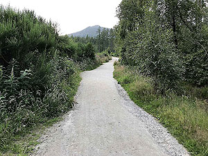
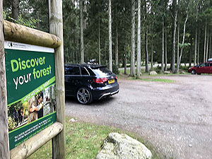
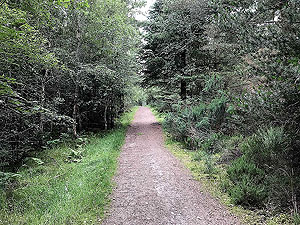
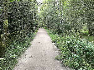
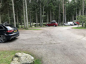
From the car park take the well signposted path for the Gordon Way which is located on the left of the information centre (as you look at it). 
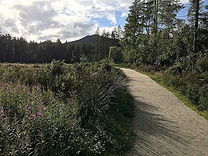
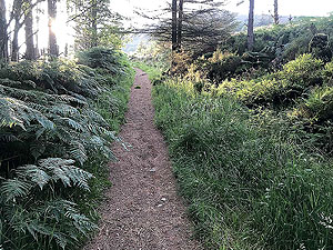
Initially this is a wide, well made dirt track but does reduce in width a little after you pass the main Mither Tap walking path. The Gordon Way path is well signposted and keep on it.
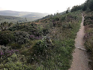
The path winds through the trees and before the
2 Kms
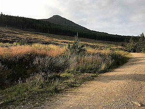
mark you are out into the open. After about
2.25 Kms
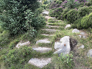
the path starts to climb and gets narrow in parts. This part of the route contains some staircases to climb which can get very slippy in certain conditions. 
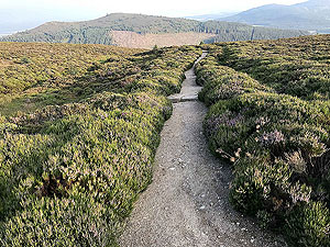
Once the climb is over the path widens and starts to bend round the hill. At certain times on the day, during certain times of the year this part is really nice. However, other times of the year it seems like all the flies in Scotland come here for their holidays.
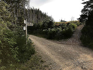
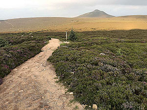
There is a very small trail heading off to the right after about
5.5 Kms
. This is close to an earlier signposted trail. This is only a short section and soon takes you out onto a larger path between Watch Craig and Oxen Craig. The route shown here avoids Watch Craig, but it is only a small detour to add this in as well.
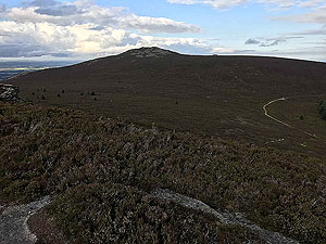
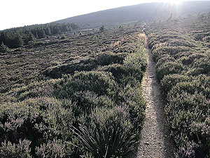
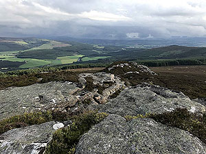
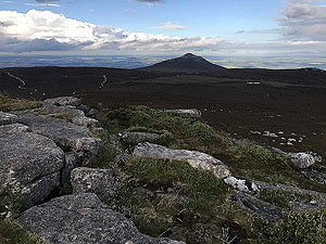
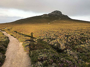
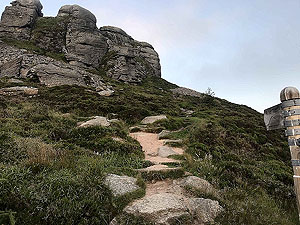
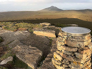
Now you are heading to Mither Tap in the distance with Oxen Craig on the way there. Although the path seems to stretch out forever 
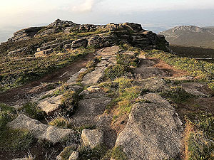
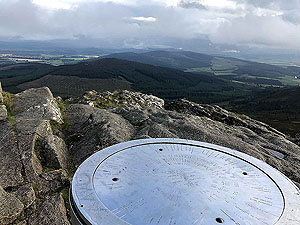
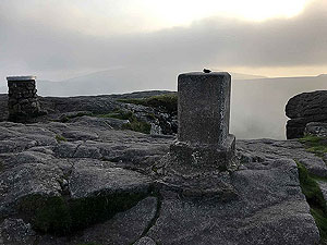
this is a really splendid part of the run. The climbs onto the top of Oxen Craig and Mither Tap are a bit of a scramble, but worth it for the views unless you are a very regular user of the route.
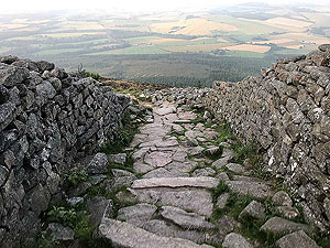
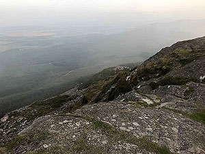
Be warned though, the first
500 m
or more of the main path down from Mither Tap is a really difficult run. Take real care here and consider walking to stay safe. Once the path approaches the tree line it becomes very runner friendly and you can really let go. 
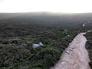
Keep and eye out for those tree roots that catch us all out from time to time.
The path from the top of Mither Tap joins onto the path from the car park. From that point you have just over
1 Kms
back to your car. Not sure if this route deserves a 3 or 4 star rating, so we will give it a 4 as we will be back again.
Route directions
Kms
1
Start from the car park

0
2
Exit car park to left of information centre

0.1
3
Out into the open

1.6
4
Take a left when you join a main dirt road

1.7
5
Sharp right up the trail path from dirt road

1.7
6
The path starts to climb more steeply

2.3
7
Path heads right and flattens out

2.4
8
Keep on the main path

3.3
9
Keep on main path as it bends to the left

4.4
10
Keep on the main path

5.4
11
Go past the first path on the right

5.6
12
Leave the main path turning right on the very small trail

5.6
13
Turn right at the main path, though Watch Craig is to the left

5.9
14
Start to climb over the rocks

6.7
15
Keep on main path towards Mither Tap, slightly on the left

7
16
Keep on main path

7.8
17
Right towards Mither Tap

8.6
18
Keep on main path, sign posted to Mither Tap

8.9
19
The path takes you across rocks to the top

9.1
20
The top

9.2
21
Keep straight ahead

10.6
22
Turn left following signs back to the centre car park

10.9
23
The end. No cafes here which is a shame

11.6
Car park area
Bennachie. Sign for car park charges
Sign for car park charges
Car park area
Bennachie. View of car park
View of car park
Car park area
Bennachie. Path leaving the car park
Path leaving the car park
Car park area
Bennachie. Car park
Car park
Picture group B
Bennachie. Good quality path at the start
Good quality path at the start
Picture group B
Bennachie. Views open out for a short while at the start
Views open out for a short while at the start
Picture group B
Bennachie. Path continues in the trees
Path continues in the trees
Through the tress
Bennachie. Path getting narrower
Path getting narrower
Start of the trail paths
Bennachie. Junction between main path and trail
Junction between main path and trail
Start of the trail paths
Bennachie. Mither Tap in the distance
Mither Tap in the distance
Climb gets steeper
Bennachie. And narrower still
And narrower still
Climb gets steeper
Bennachie. Out into the open
Out into the open
Climb gets steeper
Bennachie. The staircase section - can get very slippy
The staircase section - can get very slippy
Past the steep part
Bennachie. Through the heather
Through the heather
Out into the open
Bennachie. View across the heather
View across the heather
Out into the open
Bennachie. Looking back on the small trail path
Looking back on the small trail path
Watch Craig
Bennachie. Slightly off this route
Slightly off this route
Watch Craig
Bennachie. View from Watch Craig
View from Watch Craig
Oxen Craig
Bennachie. Towards north east
Towards north east
Oxen Craig
Bennachie. Towards Mither Tap
Towards Mither Tap
Oxen Craig
Bennachie. Easy running on the top
Easy running on the top
Towards Mither Tap
Bennachie. Mither Tap in the distance
Mither Tap in the distance
Towards Mither Tap
Bennachie. Getting close to the last climb
Getting close to the last climb
Mither Tap
Bennachie. The misty path in the background
The misty path in the background
Mither Tap
Bennachie. A spot the landmark information sign
A spot the landmark information sign
Mither Tap
Bennachie. On the top with the trig point and info sign
On the top with the trig point and info sign
Mither Tap
Bennachie. Looking back at Mither Tap
Looking back at Mither Tap
Mither Tap
Bennachie. From start of the climb looking back at path
From start of the climb looking back at path
Coming off Mither Tap
Bennachie. Very difficult to run this part
Very difficult to run this part
Gallus Running web site is using cookies to enhance the visitor experience. See our cookie policy here.Accept cookies