
Balloch to Clydebank half
The Balloch to Clydebank half route is a road run within Loch Lomond and the Trossachs. The point to point covers a distance of 21.15 Kms ( 13.14 miles )
and has an elevation gain of 89 m ( 292 feet )
.
Length
21.2 Kms
Elevation
89 m
Max elevation
30.3 m
Difficulty
**
Rating
***
Main road
11.8 Kms
Country road
0 Kms
Dirt road
0 Kms
Dirt path
9.4 Kms
Trail
0 Kms
;)
Description
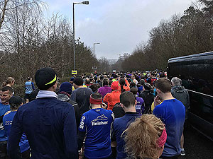
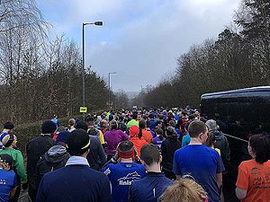
On race day we arrived about 07:30 at Clydebank to board the bus to Balloch and the start line. Social chit chat was
a bit limited due to the Corona virus, but never the less people were friendly enough.
On arriving at Balloch you can use the toilets at the shopping centre and you have about one hour before the start of the run.
The race starts in the far end of the car park and heads out to Balloch town. On reaching the main road you are quickly
taken down onto the riverside path. This is flat and rather a nice part of the run even if in 2020 parts were flooded and
the rain came on heavy for most of it. The path takes about
5 Kms
before going up a short incline at the Renton and onto
the main road.
Traffic on a Sunday morning is light but you can feel a bit exposed on this pavement as you head to Dumbarton. In Dumbarton you
have a short section on roads before you hit the cycle path near Dumbarton Academy. The path takes you along past the bonds
and then up a short incline to the Bowling roundabout. From here you are back onto the pavements in quiet roads.
On several stretches of this part running gets a little awkward due to pedestrians and cars park on the pavement. Best not to grumble
and just get on with it. Soon the Erskine bridge gives you hope that the finish is not too far.
There is a short section on Dumbarton road where the is more traffic, but as the runners have spaced out well at this
point it is not an issue.
A flat'ish race and nearly full of club runners, but they are all nice people so they tell me.
Getting in
Entry is through Entry Central though this can sell out quickly.
Getting there
Clydebank leisure centre is easily accessible with lots of parking.
Clydebank station is not far from the leisure centre.
Start
Race starts from Lomond Shores at Balloch. Buses leave from Clydebank Leisure centre to the start.
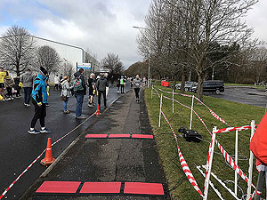
End
In 2020 the race finished about 1 mile from the leisure centre. This we were told was due to the small
changes in the route due to road works. The folks at the end are really supportive.
Finish
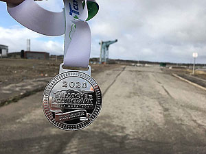
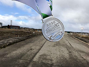
Simple goodie bag and nice enough medal and technical tee. This is a small race so the finish line is as you
would expect. We did the race in 2020 where numbers were down due to the Corona virus.
Staying
For this race we traveled on the day of the race. There are however hotels in the area and also Glasgow.
Details last updated in March 2020.
Cost
£27 at 2020 prices
When
Early March
Entry Opens
Second half of the year
Route images
Directions
×